
 Factory Automation
 Logistics Automation
 Process Automation
 Crane Collision Avoidance
 LiDAR Sensors
 Safety Laser Scanners
 Optical Data Transmission
 Hot Metal Detectors
 Laser Distance Sensor
 Blog
Blog Whitepapers
 Case Studies
 Infographics
Real-Time Mapping and SLAM
Simultaneous Localization and Mapping (SLAM) enables Autonomous Guided Vehicles (AGVs) and Autonomous Mobile Robots (AMRs) to build a map of their surroundings while determining their position within that environment in real time. While 2D SLAM remains common across many applications, 3D LiDAR provides additional environmental data that can support more accurate mapping and localization in complex industrial environments.
The UCT-10LCM provides multi-layer 3D sensing designed to support robotics and autonomous navigation applications. Its built-in Inertial Measurement Unit (IMU) supplies motion and orientation data that can be combined with 3D point cloud information to improve localization and mapping performance. This additional data helps support more stable navigation when an AGV encounters uneven surfaces, temporary obstructions, or changing production environments.
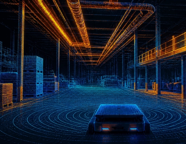
Mapping the factory floor in real time
As the 3D LiDAR sensor scans its surroundings, it continuously captures environmental data that supports real-time mapping and localization. This is especially valuable in dynamic manufacturing and warehouse environments where pallets, equipment, and personnel are constantly moving throughout the facility.
- Real-Time Mapping: High-speed Ethernet communication supports continuous updates to the SLAM map, helping AGVs adapt to changing environments as they navigate.
- Enhanced Localization: With its three-layer vertical field of view, the UCT-10LCM can capture environmental features beyond floor level, providing additional reference points that help support more consistent localization in complex industrial environments.
From Indoor Precision to Outdoor Versatility
As automation expands beyond traditional production lines, AGVs and AMRs are increasingly operating in environments where lighting conditions, airborne dust, and other environmental factors can affect sensor performance. Reliable detection requires sensing technologies that can distinguish meaningful objects from transient environmental interference.
The UCT-10LCM incorporates multi-echo technology, allowing it to process multiple return signals from a single laser pulse. This capability helps identify valid objects while reducing the impact of environmental interference, supporting reliable obstacle detection and navigation in demanding industrial applications.
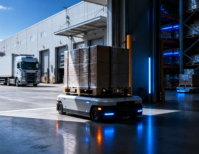
Handling harsh conditions
Even in controlled industrial environments, dust, airborne particles, and changing operating conditions can affect sensor performance. Reliable navigation depends on sensing technologies designed to perform consistently in demanding manufacturing and fabrication environments.
- IP65-Rated Protection: Designed to withstand dust and water jets in demanding industrial environments.
- Multi-Echo Processing: Helps distinguish valid objects from environmental interference for more reliable detection.
- Built for Industrial Automation: Designed to support dependable navigation and obstacle detection across manufacturing, warehousing, and material handling applications.
Choosing the Right AGV Sensors
Selecting the right sensing technology is about more than range or scan speed—it's about matching the sensor to the application. While 2D LiDAR remains an effective solution for many obstacle detection and localization tasks, more complex manufacturing and automation environments can benefit from the additional environmental data provided by 3D LiDAR.
The UCT-10LCM is designed to support applications requiring enhanced spatial awareness, including obstacle detection, pallet pocket detection, equipment navigation, and material handling. Its multi-layer scanning capabilities provide additional environmental information that can help support reliable operation in dynamic industrial environments.
Whether you're developing a new AMR, expanding an AGV fleet, or optimizing an automated manufacturing process, Hokuyo offers sensing solutions designed to help engineers and automation professionals select the right technology for their specific application.
Let's find out what's possible
Moving beyond traditional 2D sensing gives AGVs and AMRs access to richer environmental data that supports more reliable navigation in today's complex industrial environments. As automation continues to evolve, selecting the right sensing technology is key to building efficient, scalable operations.
Ready to learn how 3D LiDAR can support your application? Contact Hokuyo's team to discuss your automation goals and find the right sensing solution for your environment.