 Factory Automation
 Logistics Automation
 Process Automation
 Crane Collision Avoidance
 LiDAR Sensors
 Safety Laser Scanners
 Optical Data Transmission
 Hot Metal Detectors
 Laser Distance Sensor
 Blog
Blog Whitepapers
 Case Studies
 Infographics
You're building out your autonomous mobile robot (AMR) fleet, and one of the biggest decisions you'll face is choosing the right navigation sensors. The 2D LiDAR versus 3D LiDAR debate isn't just a technical specification — it's a decision that impacts your operational efficiency, system complexity, and ultimately how well your robots perform in your specific environment.
Let's cut through the noise and help you figure out which technology makes the most sense for your operation.
Understanding 2D LiDAR Technology
A 2D LiDAR scanner operates by emitting a laser beam that rotates in a single horizontal plane. As the beam sweeps across the environment, it measures the time it takes for light to bounce back from objects, calculating distance and angle to create a flat, two-dimensional map of the surroundings.
Think of it as your AMR's way of seeing the world at eye level. The sensor captures everything at a specific height, typically the mounting height of the sensor itself, creating a slice of spatial data that's perfect for detecting obstacles, walls, pallets, and other robots operating on the same plane.
Optional 2D LiDAR sensors used in AGV systems today are solid state LiDAR designs or use minimal moving parts, making them highly reliable in industrial settings. They deliver fast scan rates — often 25 to 40 Hz — allowing your AMR to react quickly to changes in its environment.
The data output is straightforward, distance measurements at specific angles around the sensor. This simplicity translates directly into faster processing times and lower computational requirements for your fleet management system.
What Makes 3D LiDAR Different
A 3D LiDAR sensor takes navigation to another dimension, literally. Instead of scanning in a single plane, these systems use multiple laser beams arranged at different vertical angles or employ rotating mechanisms that capture data across both horizontal and vertical axes.
The result is a point cloud — a three-dimensional representation of everything around the robot. This includes not just obstacles at sensor height, but also overhead hazards, floor-level objects, uneven terrain, and variations in surface height.
3D systems generate significantly more data points per scan. Where a 2D scanner might capture 1,080 points per rotation, a 3D system can generate tens of thousands or even millions of points per second. This richness of information enables more sophisticated navigation algorithms and better handling of complex environments.
However, all that extra data comes with tradeoffs. Processing point clouds requires more computational power, more sophisticated algorithms, and typically more advanced processing hardware on each AMR.
Comparing System Overhead: Beyond the Sensor Itself
When comparing 2D LiDAR versus 3D options, sensor capabilities are only the beginning of your evaluation.
2D LiDAR scanners are often simpler to integrate because they output a smaller, more straightforward dataset based on range, accuracy, and features. For a fleet of 10-20 AMRs, these differences can impact rollout speed and operational consistency.
However, the bigger difference shows up in your system architecture. 2D systems require less processing power, which means you can use lighter onboard computing. Your software development is simpler, your integration timeline is shorter, and your maintenance requirements are lower.
3D systems demand more robust hardware throughout your fleet. You'll need faster processors, more memory, and potentially additional cooling systems. Your software team will spend more time developing and optimizing algorithms to handle the volumetric data. Training your maintenance staff becomes more complex.
For warehouse-based operations, this additional complexity often doesn't deliver proportional value. The extra dimension of data doesn't improve navigation when your entire operation happens on flat concrete floors.
Processing Power and System Complexity
Your AGV LiDAR choice directly impacts your entire control system architecture.
2D systems process data quickly because there's simply less of it. A typical scan contains distance measurements at maybe 1,080 points around the sensor. Your navigation algorithms can analyze this data, identify obstacles, and calculate a new path in milliseconds.
This speed matters when your AMR needs to react to a forklift suddenly backing into its path or a person stepping into a corridor. Faster processing enables quicker decision-making and safer operations.
3D LiDAR sensors generate massive datasets that require significant processing overhead. Point cloud filtering, ground plane extraction, object classification, and 3D path planning all demand computational resources. Your system needs to handle this in real-time while still controlling motors, managing battery systems, and communicating with your fleet management software.
The complexity extends beyond processing. Calibrating 3D systems is more involved. Diagnosing issues requires different expertise. Software updates and algorithm improvements take more development time.
Environment Suitability: Where Each Technology Shines
Your facility characteristics should drive your sensor selection more than any other factor.
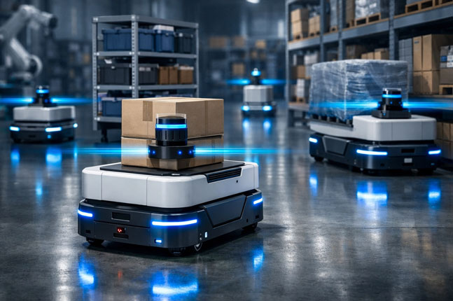
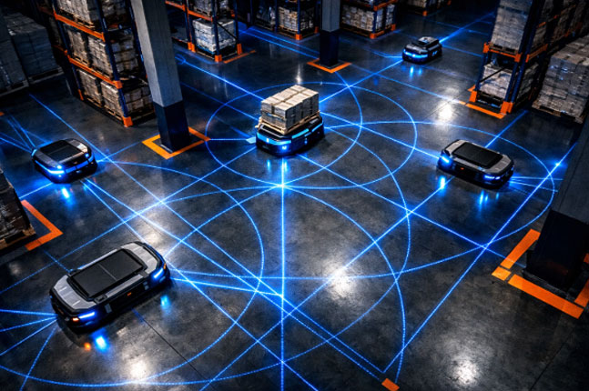
2D LiDAR excels in controlled, flat environments, which describes most warehouses, distribution centers, and manufacturing floors. When your AMRs navigate structured aisles with consistent floor surfaces, obstacles exist primarily at predictable heights, and the operational space is well-mapped, 2D scanning provides all the information your robots need.
Consider a typical warehouse AMR application. The robot moves through marked pathways, around pallets sitting on the floor, past structural columns, and alongside other vehicles. All these obstacles exist in roughly the same horizontal plane. A well-positioned 2D scanner catches everything that matters for safe navigation.
3D systems become valuable in complex, variable environments. If your AMRs operate outdoors, traverse ramps, navigate around overhead hazards, or work in spaces with significant floor irregularities, the vertical dimension matters. Outdoor construction sites, agricultural applications, and multi-level facilities benefit from 3D sensing.
The challenge is honest assessment. Many facilities that think they need 3D capabilities actually don't. Low-hanging pipes or conveyors? Mount your 2D scanner at the right height or use multiple 2D units at different heights instead of relying on a single 3D system.
When 2D LiDAR Is Your Best Choice
Go with 2D technology when your operation checks these boxes:
You're operating in a warehouse or indoor facility with consistent floor surfaces. Your AMRs don't encounter ramps, stairs, or significant elevation changes during normal operations.
Your priorities favor fleet scale and simple integration. You'd rather deploy more robots with straightforward sensing than fewer robots with complex 3D capabilities.
Your IT infrastructure is lean. You don't want to invest in high-powered computing on every robot or deal with the heat dissipation and power consumption that comes with processing 3D point clouds.
Your safety requirements focus on collision avoidance at vehicle level. Standards like ISO 3691-4 for driverless industrial trucks can be met effectively with properly implemented 2D safety scanners.
Products like Hokuyo's UST-10LX demonstrate what 2D technology can achieve: 10-meter range, 0.25-degree angular resolution, and 40 Hz scan rate in a compact, reliable package. For most AMR applications, this level of performance is more than sufficient.
When 3D LiDAR Makes Sense
Consider investing in 3D sensing technology when:
Your environment genuinely requires volumetric awareness. You're operating in unstructured outdoor spaces, navigating around obstacles at varying heights, or your AMRs need to detect and avoid overhead hazards that aren't in a 2D scanner's field of view.
You have unpredictable terrain. Loading docks with variable surfaces, outdoor yards with potholes or debris, or agricultural settings where ground conditions change constantly.
Your application justifies the added complexity. High-value applications where the additional safety margin or navigation capability of 3D sensing delivers measurable results through increased uptime, faster cycle times, or reduced incidents.
You have the technical resources to support more complex systems. Your team includes people who can work with point cloud data, optimize 3D algorithms, and troubleshoot sophisticated sensor systems.
Even in these scenarios, hybrid approaches often work well. Some fleets use 2D systems for primary navigation and add 3D sensors only on robots operating in the most challenging zones.
Making the Decision for Your Fleet
There's no universally "better" choice between 2D and 3D LiDAR — only the right choice for your specific operational context.
Start by honestly assessing your environment. Walk your facility with a critical eye. Are there genuinely obstacles or hazards that exist outside a horizontal plane? Or would proper mounting height and sensor placement with 2D units provide complete coverage?
Consider your growth trajectory. A fleet of five AMRs can justify more sophisticated sensors per unit. A fleet of fifty needs to optimize per-unit standardization while maintaining reliable performance.
Factor in your team's capabilities. Do you have robotics engineers who can work with 3D sensor data? Or is your team more comfortable with straightforward 2D implementations?
For most warehouse and manufacturing applications, high-quality 2D LiDAR provides the optimal balance of capability, integration effort, and complexity. The technology is mature, well-understood, and proven across thousands of installations. Your AMRs get reliable obstacle detection and safe navigation without the overhead of processing unnecessary dimensional data.
Finding the Right Solution
At Hokuyo, we've equipped AMR fleets across diverse industries with LiDAR sensors that match their operational requirements. Whether you're navigating structured warehouse aisles or complex outdoor environments, the right sensing solution starts with understanding your actual needs — not just the latest technology trends.
The best sensor for your AMR fleet is the one that reliably handles your environment while keeping your long-term maintenance and support requirements reasonable. For many operations, that means 2D LiDAR delivers everything you need without the complexity you don't.
Have questions about which technology fits your application? Our team helps companies spec the right sensing solutions for their specific AMR deployments. Let's talk about what makes sense for your operation.